
Planimeter Pro for map measure
Screenshots
ASO analysis
Tight against the limit — verify it doesn't truncate on small screens.
Could go longer. The first 252 chars are above-the-fold; everything else still indexes.
Used by similar apps in your niche, but not in your title or description. Adding these (where genuinely relevant) can broaden your search reach.
Words you and your peers both use. Confirms positioning in this niche.
Keyword rankings
iTunes Search · top 200About
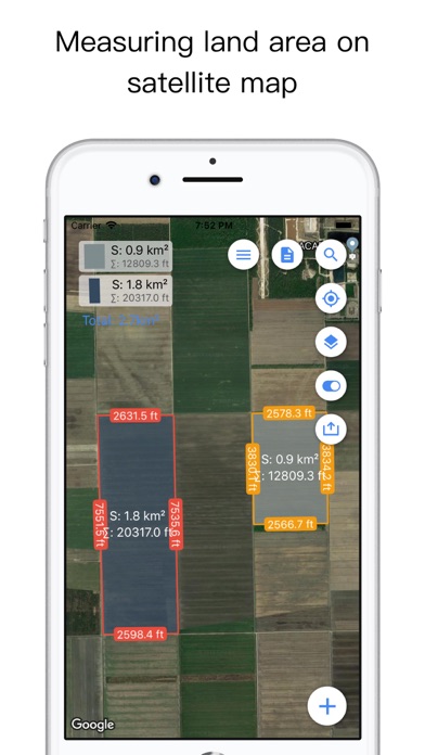
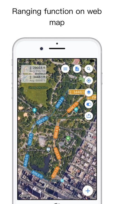
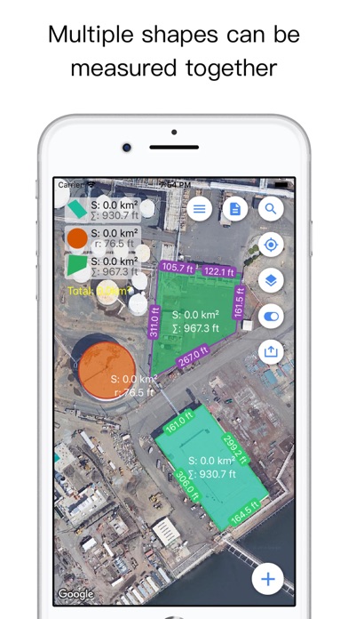
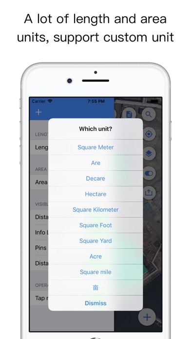
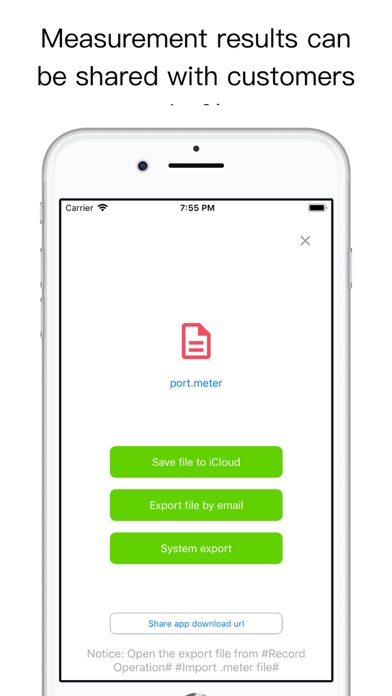
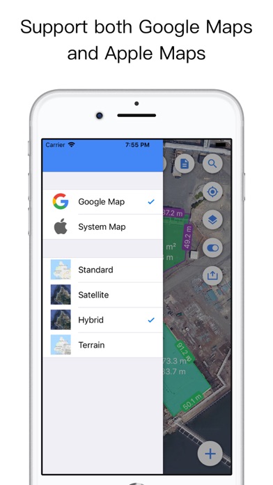
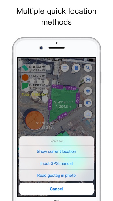
Planimeter is a tool to measure distance and area on map. It can measure anything visible on the satellite map, like lawns, fences, farm, road, roofs and so on. ~~~~~~~~~~~~~~~~~~~~~~~~~~~~~~~~~~~~ ● Thanks to more than 3250,000 people who have chosen "Planimeter Pro" ● "GREAT - Wonderful app. Very useful and easy to use. Most of the time I use it to measure distance sailed on San Diego bay." by Perfent ● "Great app for an accurate measurement - This app saves a lot of driving around! Good in the hi res areas" by DaveHebner ~~~~~~~~~~~~~~~~~~~~~~~~~~~~~~~~~~~~ Features: ● Support measure distance and area. ● Support measure as path, polygon, star or circle. ● Support measure multiple area at same time. ● Visual records list, save and share. ● Support Apple map and Google map. ● Use cross hair to location, easy and accurate. ● Locate by search or GPS. ● Support length unit like foot, nautical mile, mile,inch, yard, meter,kilometer. ● Support area unit like square meter, are, declare, hectare, square kilometer,acre and so on. ● Support custom unit, add any unit your needed. ● Fill color, board color and text is configurable. ● Support live record by GPS. "Continued use of GPS running in the background can dramatically decrease battery life."