
Touch GIS
Screenshots
ASO analysis
Short title. You're leaving keyword space on the table.
Solid length. Make sure the first 252 chars hook the reader.
Used by similar apps in your niche, but not in your title or description. Adding these (where genuinely relevant) can broaden your search reach.
Words you and your peers both use. Confirms positioning in this niche.
Keyword rankings
iTunes Search · top 200About
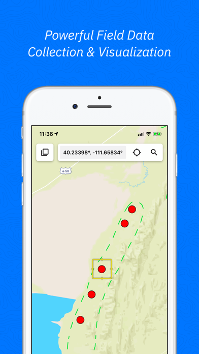
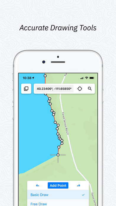
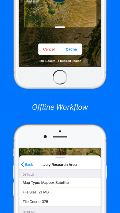
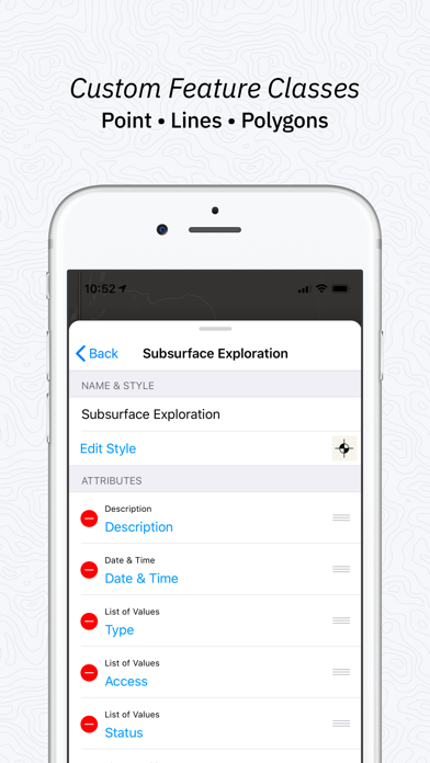
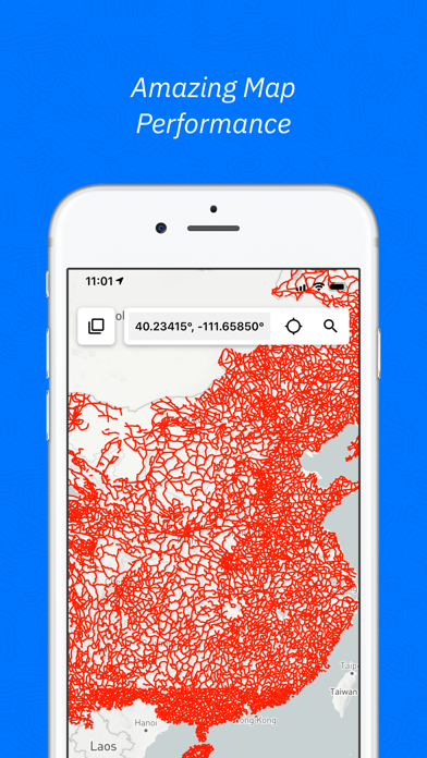
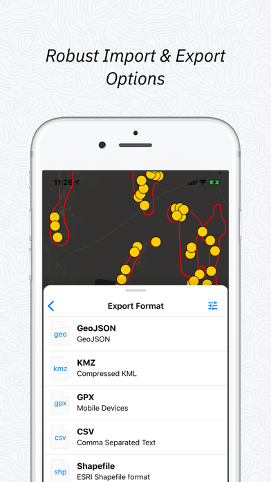
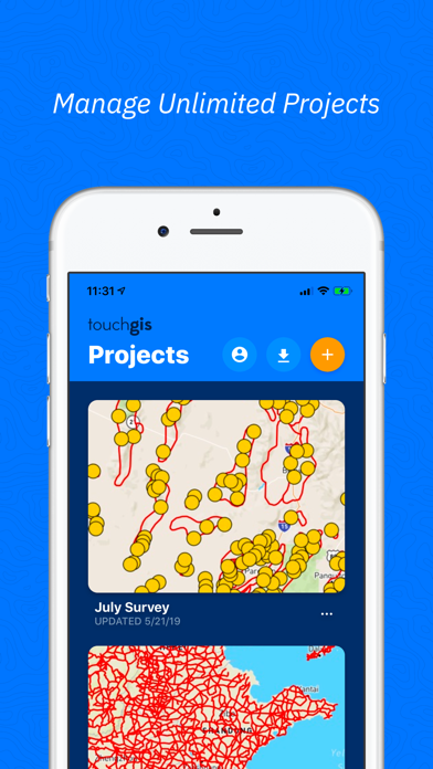
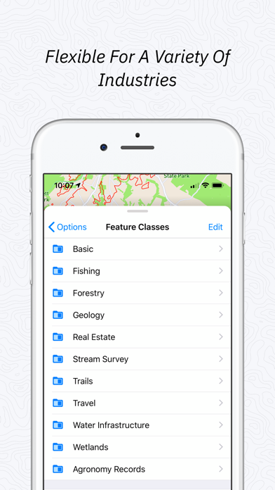
Touch GIS is the most intuitive professional field data collection and mapping tool. It's a super-powered field notebook enabling you to collect any kind of data, in any environment, online or offline, and transfer it easily to your preferred desktop GIS. We believe your data collection tools should amplify your capabilities, not limit them, which is why we focus on keeping your forms and attributes totally customizable in the field. Join thousands of professionals utilizing Touch GIS as their mobile GIS app to enhance their field work in geologic mapping, ecological mapping, civil engineering, mineral exploration and mining, natural resource management, landscape architecture, and more. FEATURES - Easily create new Points, Lines, Polygons, and Circles in the field. - Quick and simple line and polygon drawing with free draw mode and vertex snapping. - Quickly adjust feature class collection and attribute forms in the field at any time - Get multiple perspectives by switching between base maps in the field - Save map tiles for offline use - Export to a variety of industry standard formats - Snap, mark up, and attach photos to locations - Measure planar and linear feature orientation using our clinometer tool with strike/dip, dip/dip direction, or trend/plunge formats. - Add custom base maps with WMS/WMTS - Add Rasters, Geospatial PDFS, and other overlays to your map to see your location in context - Add team members so your whole team has access FILE TYPES SUPPORTED - Shapefile - KML and KMZ - GeoJSON - GPX - CSV - World File - Geotiff - JPG - PNG - Geospatial PDF and GeoPDF - GeoPackage (GPKG) Customizable attribute types: - Description - Date & Time - Photos - List Of Values - Checkbox - Address - Number - Website - Phone Number - Attitude / Orientation - Make your own PRELOADED FEATURE CLASSES - Forestry - Geology - Real Estate - Stream Surveys - Water Infrastructure - Wetlands - Create Your Own! Terms of Service: https://www.touchgis.app/terms-of-service Privacy Policy: https://www.touchgis.app/privacy